


cala canyelles lloret de mar

raab
User
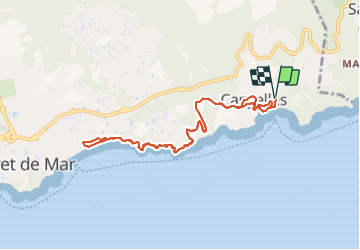

Length
10 km

Max alt
104 m

Uphill gradient
321 m
Km-Effort
14.3 km

Min alt
2 m

Downhill gradient
322 m
Boucle
Yes
Creation date :
2022-01-22 09:41:11.869
Updated on :
2022-01-22 13:37:41.045
3h55
Difficulty : Difficult

FREE GPS app for hiking
 SityTrail
IGN / Geographical institutes
SityTrail Plus
The world is yours!
About
Trail Walking of 10 km to be discovered at Catalonia, Girona, Lloret de Mar. This trail is proposed by raab.
Positioning
Country:
Spain
Region :
Catalonia
Department/Province :
Girona
Municipality :
Lloret de Mar
Location:
Unknown
Start:(Dec)
Start:(UTM)
490243 ; 4617113 (31T) N.
Comments